Nootka Sound Communities
The communities of Nootka Sound all have a few things in common.
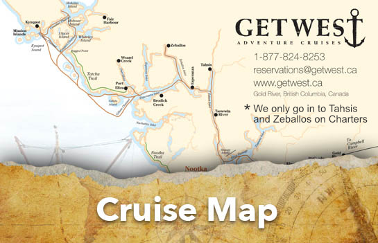
They are remote, many of which have no road access and rely on the MV Uchuck III to deliver food, supplies, mail, provisions, fuel and more. They are steeped in native culture and history. They are located at spectacular settings on Vancouver Island’s Northwest Coast. They all offer an abundance of outdoor pursuits.
Gold River
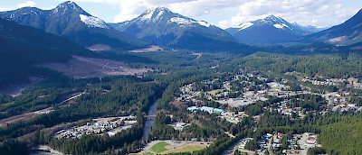
Gold River is located at the west end of Highway 28, a scenic one hour drive from Campbell River. Many visitors use it as a base for exploring the surrounding wilderness and rainforest trails, accessing the Nootka Trail, or as a gateway to Nootka Sound. The Municipal Wharf at Gold River is home port to the MV Uchuck III, Air Nootka seaplane service, and the launch point for sports fishing enthusiasts.
Gold panning attracted Chinese miners into the traditional territory of the Mowachaht and Muchalaht peoples in the 1860s, and the name Gold River first appeared on maps in 1871.
In the early 1960s the Tahsis Company logged at the mouth of the river. In 1964 they began building a 750 ton-a-day Bleached Kraft Pulp Mill there, because of the flat delta land, the deep-sea access for ocean-going freighters, and the steady source of water.
The Tahsis Company also selected a site eight miles east of the mill on which to build a town to service the needs of the mill. In 1965 Gold River, a resource-based community was born, known as Canada’s first all-electric town and the first in Canada with underground wiring. Incorporated in 1965 as a District, it re-incorporated itself in 1972 as the Village Municipality of Gold River.
In the late 1980s, the mill added a paper manufacturing component, thus creating a short-term building boom and increasing employment. However, newsprint prices soon collapsed amid a glut of new supply, the cost of wood chips increased, and high interest rates proved so crippling that in 1993 paper production shut down. In 1998 the original mill ceased operations permanently.
As working families moved away, many of the houses in the town were sold at auction- some to Europeans. Since then Gold River has reinvented itself as a west-coast tourism hub. Recently the focus of the local economy has diversified to include adventure tourism, capitalizing on the incredible natural surroundings of the village and region.
Each year, hundreds of new visitors discover why this region is considered “The Cave Capital of Canada”. The Upana Caves are easily accessible and offer novices a safe, self-guided introduction to the sport of spelunking. If you would rather get your exercise above ground, choose from rock climbing at Crest Creek Crags, mountain biking on one of the most challenging trail systems in Western Canada, or hike one of the many picturesque trails.
For wildlife viewing opportunities take a prearranged tour of the Conuma Hatchery, located 36.5km past the Gold River Visitor Centre, and watch the spawning salmon, or drive 2.4km further and visit the Conuma River Estuary (take the Moutcha Bay access road) to catch a chance glimpse of a black bear, elk, or black-tailed deer.
Gold River continues to impress fisherman with consistently large and lengthy runs of Chinook, Coho, Sockeye and Chum Salmon. Fishermen and women can enjoy sheltered, relaxed fishing in the protected waters of Nootka Sound or they can venture off shore to enjoy a truly wild west coast fishing or marine wildlife adventure.
Visitors to Gold River have a number of choices for accommodation in hotels and B&B’s as well as great restaurants to enjoy and galleries that exhibit the work of local artists. Other amenities include a Visitor Center, two campgrounds, aquatic and community centre, golf course, service stations, grocery store, liquor store, post office, drug store as well as other shopping opportunities.
Within the community there are baseball fields, basketball and tennis courts, playgrounds, churches and incredible hiking and biking trails. So for a day trip or a longer excursion check out Gold River and the surrounding area. Consider also a visit to Antler Lake, Star Lake and Scout Lake.
The Artists of Gold River
While in Gold River we invite you to discover the creative and diverse artwork that is inspired by the natural beauty and history of our area. As you enter town you will notice a large carved boot which commemorates the ‘Great Walk” from Gold River to Tahsis. The creator, Lee Yateman, using a chainsaw, skillfully carves anything from boots to bears. He has carved custom items such as turtles, monkeys and a life size miner. You can view more of his work at www.gogetlee.com.
Clayworks Café & Gallery (and the studio of North Island Clayworks) is located on the corner of Muchalat and Industrial Park Place, just over the Gold River on your way to the waterfront. Customers are greeted with the aroma of fresh organic coffee, homemade baking, fresh soups and sandwiches as well as a full breakfast menu. The artists display and sell their pottery throughout the Cafe. Their studio is located next door and they offer tours to visitors who are interested in seeing a demonstration at the potter’s wheel or would like to learn more about the process. Their gallery also supports the work of other local artists in the form of photography, paintings, cards, cranberry preserves and wood turning. You may find the perfect gift or a keepsake of your trip to Gold River at Clayworks Café & Gallery. Visit their website at www.clayworkscafe.com.or like them on Facebook. www.clayworkscafe.com
The Art Center is located in the Village Square Plaza and features the work of some of the local amateur and professional fine artists. Drop by the Arts Center to see the artists at work.
If you are making the trip to Friendly Cove don’t miss the handcrafted work of local native artist Sanford Williams. In the summer months Sanford makes Friendly Cove his home. Visit Sanford at the Cove and see him carving a mask or any other piece that he may be working on. www.sanfordwilliams.com
Bill Maximick, a prominent West Coast marine artist resides in the Comox Valley. He has been painting images of Nootka Sound and the MV Uchuck III since his first commission in the early 1980s. To date he has created close to a dozen paintings of the Uchuck. Over the years he would help out on board, taking trips to enable himself to photograph the west Coast he loves which is reflected in his many paintings. You can visit him in his gallery in Courtenay, BC or see his work at www.billmaximick.com.
For more information contact the Gold River Visitor Centre: 250-283-2418
goldriverchamber@gmail.com www.goldriver.ca
Gold River Chamber of Commerce Open weekends Mid-May - July 1 • Open Daily ~ July 1 - Labour Day
Tahsis
Tahsis means ‘Gateway’ or ‘Passage’ in the language of the Mowachaht First Nations people who have lived in the region for thousands of years. They maintained a permanent winter settlement in the protected inlet, and used a network of trails up the Tahsis and Nimpkish River Valleys in order to cross the mountains and trade with the native villages on the eastern side of Vancouver Island.
Located in the heart of historic Nootka Sound, Tahsis Inlet and the surrounding Rugged Mountain Range, this area is becoming well known for scuba diving, caving, sea kayaking, hiking, bird watching and wildlife viewing plus excellent salt water fishing and the opportunity to land some of the largest salmon and halibut caught in B.C.
Starting in May, resident six gill sharks and their inquisitive juveniles are seen regularly in 30 feet of water, right here in downtown Tahsis. Tahsis has become known as another ‘Caving Capital’ with its vast networks of caverns in nearby hills, including Thanksgiving Cave the longest in B.C. at 3.4 miles. Black bears and eagles are especially plentiful and in the fall are drawn into the town site by the Chinook and Coho spawning in the Tahsis River. This provides incredible photo opportunities!
For those who want to experience the wild Pacific coast at its most rugged, the Nootka Trail offers a challenging hike comparable to the West Coast Trail, but without the crowds and reservations. The exposed western coastline of Nootka Island provides excellent conditions for expert kayakers and surfers seeking extreme sport, with waves arriving daily from Japan, and is known as a hot spot in the world surfing community. There is a small fee of $45.00 (per person) to cross the land at Friendly Cove. The proceeds go towards upkeep of the church (Cultural Centre) and grounds.
For those who prefer to explore the picturesque original townsite, there is a leisurely historical walking tour and newly established Museum depicting life as it was since the 40’s. Enjoy a leisurely stroll on the Tahsis Leiner Estuary Boardwalk Trail.
The Annual Westview Marina Fishing Derby takes place the 3rd weekend of August with anglers competing for thousands of dollars in prizes. Past winners have hauled in Chinook salmon that tipped the scales at over 40 lbs.
The starting point for your adventure is the “Tree to Sea Drive, The Road to Adventure.” Pick up your map at the visitor Centre in Gold River!
For more information: Village of Tahsis 250-934-6344
Zeballos
Flanked by towering forest-cloaked mountains, Zeballos sits at the head of Zeballos Inlet, gateway to Nootka Sound, world-famous for salmon fishing and kayaking opportunities. The inlet was named by Captain Alejandro Malaspina in 1792 after one of his lieutenants, Ciriaco Cevallos.
The discovery of gold in Zeballos in the 1920s resulted in a massive influx of miners and adventurers. The historic buildings in the village are a living reminder of those frontier days. The small but informative Zeballos Heritage Museum tells the tales of the gold rush and the resulting boomtown with pictures and artifacts. Shady boardwalks and walking trails wind through the estuary and along the river, providing visitors with an opportunity to enjoy the native plants and wildlife of the rainforest.
The Zeballos River estuary, a bird watcher’s paradise, has been designated a Wetland Reserve by the Ministry of the Environment and the Nature Trust of British Columbia. With the river running through the center of the village there’s not much need for a nature channel on TV.
During the salmon spawning season in the fall, the river teems with fish. Bears and eagles that arrive to partake of the annual feast can be watched from the Sugarloaf Bridge. Trumpeter swans drift down the river, competing with the seagulls for newly laid salmon eggs.
West Coast Comfort & Friendly Service!
Zeballos has become a hot spot for kayakers accessing Catala and Nuchatlitz provincial marine parks, the islands of Kyuquot Sound and the rest of the spectacular northwest Pacific coast of Vancouver Island. Kayaks are available for rent for visitors wanting to explore the estuary where kelp fronds sway in the waves. Kingfishers dart by as you drift in the sun while seals and sea otters pop up and down checking your progress. Eagles soar overhead while great blue herons stalk through the tidal flats. Humpback whales frequent the inlet as well.
A municipal dock can accommodate oceangoing ships, with full facilities for recreational boaters and floatplanes, including coin-operated showers. A Forestry Recreation site at Fair Harbour is ideally located for continuing your adventures with explorations of Tahsis and Amai Inlets or the beautiful ocean beaches of Rugged Point Provincial Park.
For the more adventurous, Rugged Mountain and the slab in the Nomash are well-known to rock-climbing enthusiasts. Limestone erosion along the Quatsino River has produced thousands of caves. Artlish Caves Provincial Park and Little Huson caves can be accessed just off the road into Zeballos.
For more information: Zeballos Village Office: 250-761-4229
Zeballos Heritage Museum: 250-761-4070
Kyuquot
An archipelago of nine islands and the mainland make up Kyuquot, a village of 350, surely one of the most unique on BC’s coast.
During the initial European contact period in the 1780s, sea otter traders in search of pelts ventured into the Kyuquot Sound area to trade with the Kyuquot and Checleset peoples. The rugged terrain and numerous reefs, however, made Kyuquot Sound difficult to navigate and with the extinction of the sea otter populations, Kyuquot Sound and Kyuquot soon fell back into obscurity.
In the mid-1850s, the lucrative seal fur trade, and the harvest of fish oil, brought trade back into the Sound. Fur sealing schooners began making routine stops at Kyuquot’s fishing villages to take aboard First Nations men as hunters, and the sealing industry grew until 1911 when it was outlawed in an attempt to protect the species from extinction. Whaling replaced the sealing industry and in 1908, the Pacific Whaling Company constructed a whaling station on Cachalot Inlet to process humpback and blue whales into oil, fertilizer and meat.
Despite only seasonal hunting, the Kyuquot station processed 4,765 whales until poor markets and depleted whale stocks closed the station in 1925, and caused many of the Norwegian and Scandinavian whalers to turn to fishing for their livelihood. They and their families remained in Kyuquot Sound, many settling in Walter’s Cove on the protected side of Walter’s Island, across from Houpsitas, the traditional winter home of the Kyuquot people. These two communities form the Village of Kyuquot.
Today commercial fishing and the forest industry remain the major employers, with tourism increasing in popularity. Tourism is slowly attracting more and more people to this remote, very unique maritime village, and to its surrounding area, for sport fishing, kayaking and enjoying outdoor adventures in an absolutely spectacular setting.
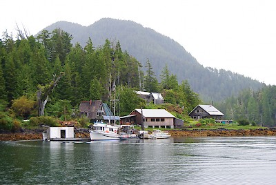
The original First Nations village is situated on the mainland and across from it on Walter’s Island, with two dozen buildings connected by a boardwalk, sits the “central business district”. Stop for a bite at “The best restaurant in town”, Miss Charlie’s, named after the town’s mascot: Miss Charlie, a seal, saved as a pup despite the $5 bounty on her head, she continues to swim around the harbour scrounging a handout. With no streets, Kyuquot residents use boats to access the Red Cross Outpost, the school, the post office, the fishing lodges and stores around the various coves.


